
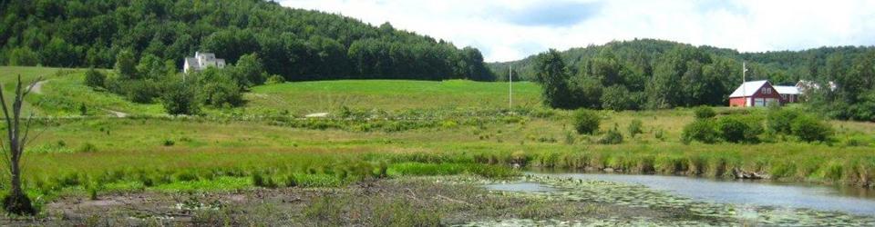
The most cost-effective way to moderate flooding is to protect the natural systems that are already in place. Identifying and protecting the natural flood protection assets that your community depends on is the most inexpensive and effective way to increase the flood resilience of your community. In order to protect these assets, you must first understand them.
On the next pages you can learn more about:
Animation: A new type of river management is coming!
Here's a short animation from France that beautifully captures the Vermont Rivers Program mission to make human and natural communities safe and healthful through the protection of natural flows, floodplains and meandering rivers. This type of river management is practiced in Vermont.
A short animation film on river management (GEMAPI) by the Rhone Mediterranean Corsica water Agency. 3.5 minutes
Video: How the Otter Creek Floodplain Responded to Irene
About the video: in West Rutland, the Otter Creek leapt up as Tropical Storm Irene struck, increasing in flow by nearly 20 times in the space of a little more than a day, while downstream in Middlebury the river rose much more gradually, (and more safely). The film is narrated by Gov. Howard Dean. This 11 minute video was produced by Riverbank Media for the Connecticut River Conservancy (CRC) and the Conservation Law Foundation (CLF).
Damage from flooding can be avoided by choosing safer building sites away from floodplains and areas that will erode over time. In Vermont the damage from flood events falls heavily on roads, culverts, and bridges. These public investments are critical for emergency services, school systems, and our economy. Roads will inevitably need to cross rivers and streams. We can build these structures to be compatible with the stream and reliable for our needs in an emergency.
The damage from flooding is primarily due to the power of moving water. When we make land cover changes in our watersheds we need to plan to maintain or reduce the amount of water coming downhill.
How can we protect the forests in our watersheds that slow down the flow of water and reduce the damaging peak flows?
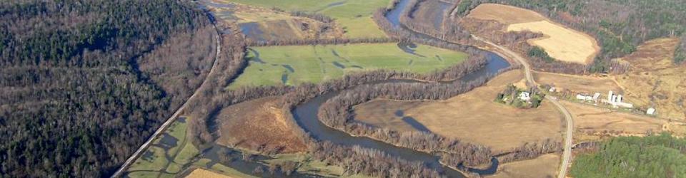
How can we create the space for streams and rivers to maintain equilibrium?
How can we delay water uphill on floodplains and soak it into permeable soils?
As we plan for a flood resilient future we need to identify the existing landscape elements that are already working for us. Before we lose these elements, and make the situation worse, we need to protect these functions. If these elements are not available we can work to restore them.
Resources
Jenny Coolidge Brook Culvert Response Irene
CRWC and CLF also looked at the decision to install larger culverts, including near the headwaters of the West River high in the Green Mountain National Forest. One such culvert, on Jenny Coolidge Brook, still stood after Tropical Storm Irene while others near it failed, preventing a costly replacement and preventing erosion and other flood damage.
Reading Rivers, VNRC 2013 (Recent overview of issues and best practices)
Living in Harmony with Streams: A Citizen’s Handbook to How Streams Work, Friends of the Winooski, 2012
Protecting River Corridors in Vermont, Michael Kline and Barry Cahoon, 2010. Journal of the American Water Resources Association (JAWRA) 1-10
Vermont’s Roadmap to Resilience The Institute for Sustainable Communities (2013)
ACCD Rebuilding Stronger – Learning from the Mad River Watershed (2013)