
We are all at risk of damage from flooding. Our roads and rail lines cross streams and rivers. Sometimes our critical buildings, such as town halls and fire departments, are in a floodplain. At times, natural flood protection, such as wetlands and forested watersheds, adequately protects our buildings and infrastructure by reducing the volume of water flowing through our communities during storms, but what happens when natural protection isn't sufficient?
It is important to understand what we face and take steps to adapt - and the time to address flood hazards is now. Otherwise, we risk losing important community assets.
We provide two tools to help you understand your community's overall risk to flooding and to help prioritize  action.
Links to sections below:
Community Reports
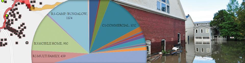
Generate reports for your community and region that inform your overall exposure to flooding, such as how many buildings are in the Special Flood Hazard Area and whether your community is qualified for post-disaster support from the Emergency Relief and Assistance Fund (ERAF).
Map Tools
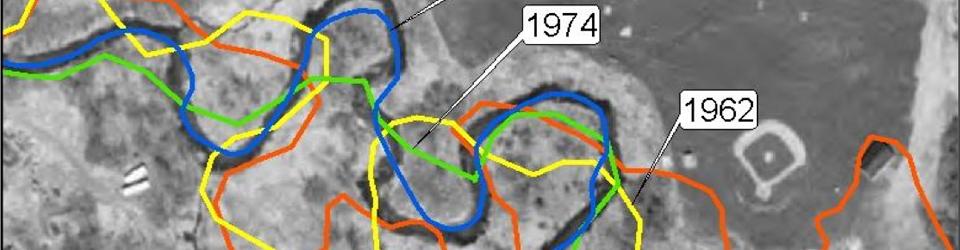
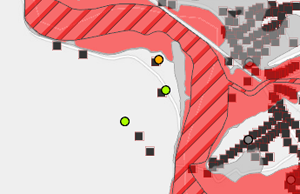 Use maps to get the big picture of what your community faces. Learn more about available map tools. Then, use the Vermont Flood Ready Atlas to learn more about your community's risk and what adaptations might reduce it. Find the natural flood protection areas that should be preserved, where is it safe and unsafe to develop, and which structures need to be moved or improved.
Next Steps
Once you have a better understanding of what protects your community and what places it at risk, it’s time to update your plans and identify the key steps needed to protect your community. How will your community protect the landscape features that protect your community? How can your community adapt culverts, bridges, prepare critical infrastructure and historic buildings and direct future growth to safer places?
Learn how to update your plans.