
Please update your weblinks and bookmarks to the new urls:
- VT/ BTV: https://water.noaa.gov/wfo/btv
- Johnson: https://water.noaa.gov/gauges/JONV1
- Montpelier https://water.noaa.gov/gauges/MONV1
- Waterbury https://water.noaa.gov/gauges/WATV1
- All VT Gauges https://water.noaa.gov/area/BTV#river21
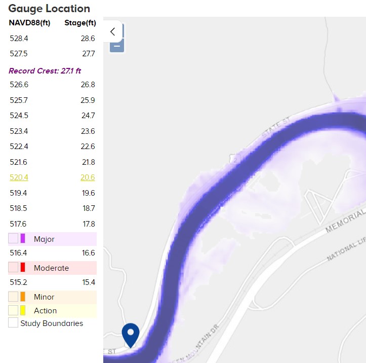
The map display can be toggled to display the base flood for the NFIP.
In Montpelier and Waterbury the map display can also display a range of flood extents as predicted or selected through the FIM/ Flood Inundation Mapper (as below).
3/27/2024 Dear Partners,
TODAY the NWS launched the modernization and replacement of the Advanced Hydrologic Prediction Service (AHPS) webpage with the National Water Prediction Service (NWPS). AHPS provides critical hydrologic information, especially during extreme hydrologic events including river observations and forecasts. If you are a frequent user of the AHPS webpage, you will find the same information and more with the new NWPS.
Important note: Bookmarks for AHPS connected pages will be discontinued on or around June 1st.
- What is NWPS: The NWPS web dissemination platform will be the replacement for AHPS and the gateway to NWS water information. NWPS will leverage the NWS’ Enterprise Cloud System, and a modernized Web technology framework integrating geospatial technology and web services to disseminate critical hydrologic information to you year round. In addition to the enhanced Graphical User Interface (GUI), NWPS will include an Application Programming Interface (API) that will allow you to integrate operational forecast information within your own applications.
- NWPS URLs are:
- Main Page: https://water.noaa.gov/
- Local site for NWS Burlington is https://water.noaa.gov/wfo/btv
- API: https://api.water.noaa.gov/nwps/v1/docs/
- AHPS URLs that will be changing in NWPS: https://www.weather.gov/media/notification/pdf_2023_24/scn24-29_nwps_url_changes.pdf
- Main Page: https://water.noaa.gov/
- NWPS Resources: Visit https://weather.gov/owp/operations (scroll down after visiting the hyperlink) to find resources and informational material that aid in the transition to NWPS. Available materials include webinars, fact sheets and flyers, story maps, and a user guide.
- Informational Storymaps:
- A User's Guide to National Water Prediction Service (NWPS) - includes helpful screenshots and videos of key NWPS features
- Using the National Water Model Within NWPS - includes information about how to display NWM in NWPS, how NWM guidance differs from the official forecast, and how NWM handles ice, snow, gage assimilation, reservoirs, etc.
Thank you for your close partnership with the NWS. If you have any questions on these new web capabilities, do not hesitate to contact us, especially John Goff (john.goff@noaa.gov) our Senior Service Hydrologist. Stay tuned for refinements and enhancements over the course of the next year as we work to realize the nimbleness and flexibility of modern software engineering practices, geospatial technology and cloud infrastructure.
Warmest regards,
NWS Burlington