How many public buildings are in the Special Flood Hazard Area (SFHA)?
How many structures in the flood hazard area have insurance today?
What are the next steps we can take to become more flood resilient?
 The links below will bring you to the search box for each report.
Be sure your browser allows pop-ups so you can see the reports!
Community
- Expanded Community Report
Flood risk data, ERAF mitigation actions and dates, and status of plans.
Summaries by community, region, county, or state
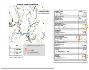
- Flood Hazard Summary Report
Summary of flood risk data and mitigation actions for ERAF.
- ERAF Summary Sheet
Community mitigation actions and dates for ERAF. -
Municipal Road and Bridge Standards Summary Report
Summary of standards and grants Information
More
- Recent Data Updates
- How are the ERAF Data Updated?
- If You Think a Record May Be Wrong
- More on Interim Criteria for ERAF
You must have "pop-ups enabled" to view the reports!
Expanded Community Report
Flood risk data, ERAF mitigation actions and dates, and status of plans.
Flood Hazard Summary Report
Summary of Flood risk data and mitigation actions for ERAF.
ERAF Summary Sheet
Community mitigation actions and dates for ERAF.
Municipal Road and Bridge Standards Summary Report
Municipal River Corridor Protections Summary Report
FEMA Data and Other Reports Online
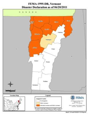
FEMA: Disaster Declarations for Vermont
National Flood Insurance Program (NFIP) Community Status Book (Communities participating in NFIP, date of enrollment, current status) For information on the types of structures in SFHA and addresses of public or critical facilities in your community contact us.
Number of effective flood insurance policies in the SFHA. Currently in Vermont (4/1/2024) there are 2,223 NFIP flood insurance policies in Vermont covering $562 million in value. Of these 1,160 are for structures identified as high risk Special Flood Hazard Areas. Of roughly 10,000 structures in the SFHA in Vermont it appears that about 12 % have some flood insurance coverage. Some of the remainder are muncipal structures that may have independent insurance through the Vermont League of Cities and towns (VLCT) and Property And Casualty Intermunicipal Fund (PACIF). Most structures in the high risk area do not have a flood insurance policy in force.
Repetitive Loss Structures with current insurance policies in the SFHA. (6/26/2018) Structures that have repetitive damage claims heavily impact the insurance pool and the affordability of flood insurance. The Stafford Act Mitigation Programs direct funds to reduce the risk to these structures through mitigation grants. Since 2012 the cost of flood insurance for Repetitive Loss structures is based on elevation.
Community Rating System - Savings in Vermont (6/18/2019) - This list identifies the seven communities in Vermont that currently have qualified at the Class 9 or 8 level of the Community Rating System (CRS). Policy holders in these communities are able to secure flood insurance discounted by 5-10%. The report identifies the average benefit to policy holders and the community as a whole.
OpenFEMA Datasets - Choose "Show Details" for data abstracts
FEMA Public Assistance (PA) Funded Projects Summary - OpenFEMA Dataset
FEMA PA Funded Projects Detail - OpenFEMA Dataset
FEMA Daily PA Grant Awards OpenFEMA Dataset
FEMA Hazard Mitigation Program (HMGP) Summary - Open Government Dataset
FEMA HMGP Property Acquisitions Dataset
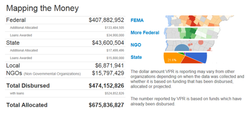
VPR Mapping the Money - Federal, state, local and non-governmental funding released in response to damage from Tropical Storm Irene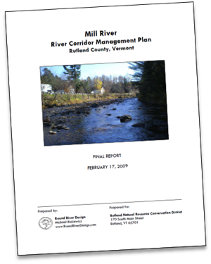
VTrans Online Bridge and Culvert Inventory Tool
VT DEC Stream Geomorphic Data Management System Bridge and Culvert Database
River Corridor Plans and Geomorphic Assessments
Basin Plans and Water Quality Resources - Tactical priorities for clean water in 17 Vermont basins with a focus on reducing runoff from development and restoring degraded streams, rivers and lakes.
Spatial Hazard Events and Losses Database for the US (SHELDUS) - State and county level reports of damage from disaster events
Also, visit the Resources page.
Recent Data Updates
The Flood Ready Vermont - Community Reports compile data from the primary agencies that are responsible for the information. All the data arrives through a chain of responsibility. Some of these data are only available here and other data are periodically updated. The list below indicates that last time the database was updated from the primary agency.
Data and Primary Agencies - Last Update on Flood Ready Database:
- National Flood Insurance Program, FEMA - 12/13/2023 (Updated by ANR from FEMA CIS)
- Town Road and Bridge Standards VTrans - (Updated by VTrans Regional Project Engineers)
- Town Highway Mileage - VTrans (inclusive of Classes 1 - 4)
- Local Emergency Management Plan, VEM - Updated at least monthly. Reports only available here.
- Local Hazard Mitigation Plan, VEM - Updated as received. Reports only available here.
- Protect River Corridors, ANR - 6/28/18 Reports only available here.
- Community Rating System (CRS) and Floodplain Protection, - 11/28/18 FEMA and ANR
- Municipal Plan and Bylaw Dates - Annual as reported to ACCD by RPCs - (updated by ANR)
- E911 buildings updated from EmergencyE911_ESITE data 3/16/17
How are the ERAF Data Updated?
The data for ERAF are managed by the agencies that are responsible for the information. Please click here for more on How ERAF Data are Updated.
If You Think a Record May Be Wrong
It may be. If so - we certainly want to hear about it.
Your community may have recently updated something but it may not show up here until the next scheduled update.
Check with your Regional Planning Commission to see if the document was received by the primary agency. When the primary agency has reviewed the community action and posted it, then it can be incorporated into the Flood Ready Report at the next update.
If you know a record is wrong, please ask the appropriate agency to check and update their record on Flood Ready.
More on Interim Criteria for ERAF
More on Interim Criteria for the Emergency Relief and Assistance Fund (ERAF).


